
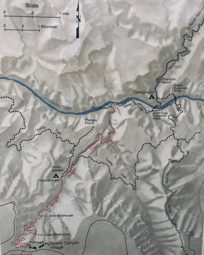
The Grand Canyon is the most iconic United States National Park and the Bright Angel Trail is it’s most iconic trail. The Bright Angel’s total distance from the South Rim to the Phantom Ranch Campground on the Colorado River is 9.5 miles. The trail was on our bucket list and I managed to snare a Rim Cabin at the Bright Angel Lodge 13 months prior to going. Our cabin had a sweet little fireplace that helped take the chill off the morning before we took off to hike. We decided to meet our friends, Rob and Jennifer, at 6:20 am so we could enjoy sunrise on the trail.
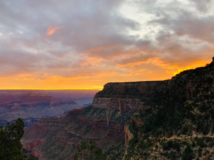
We had a smidge of trouble finding the actual start of the trail as we had begun walking on the wrong sidewalk initially, but it was literally just 4 minutes from our cabin. Perfect spot to start out and nearly nobody on the trail! Temp was just a bit brisk at that time of morning, but we lucked out as the weather was warmer at sunrise than the mid 40’s that had been forecast for most of the week- but that day in late September it was all the way up to a balmy 50 degrees.
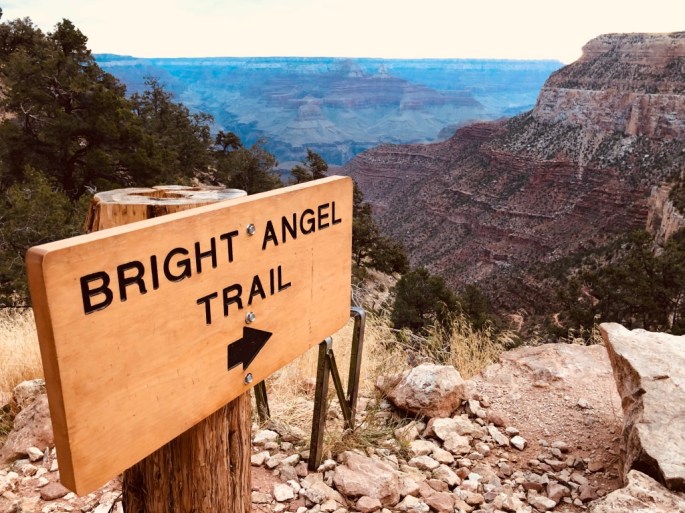
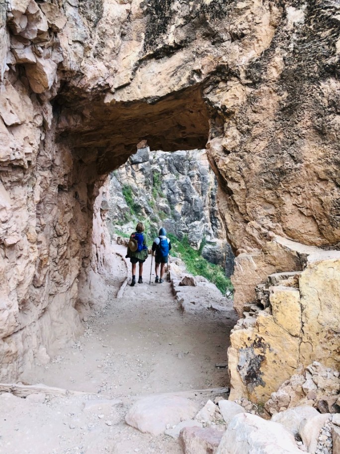
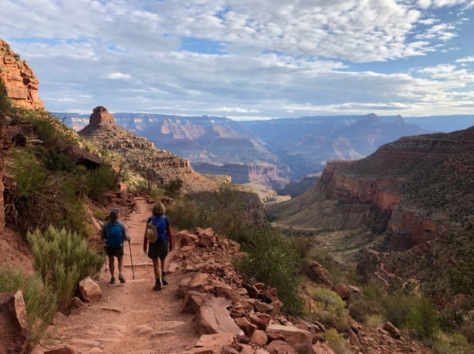
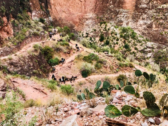
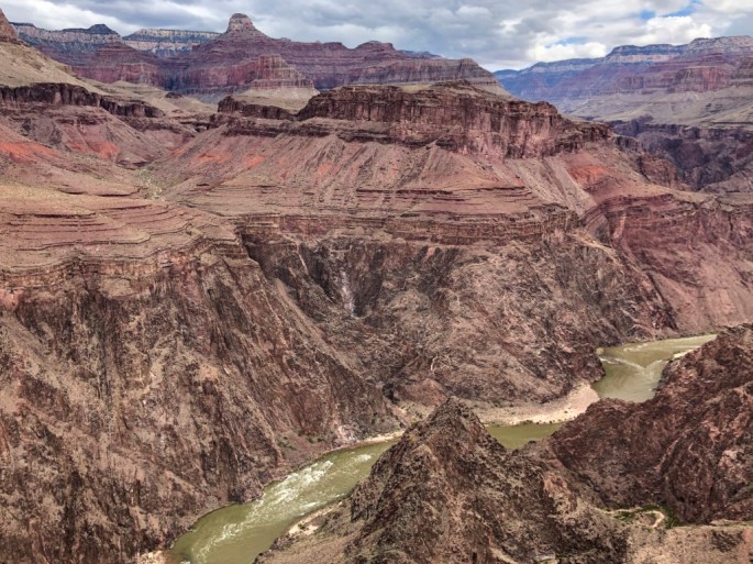
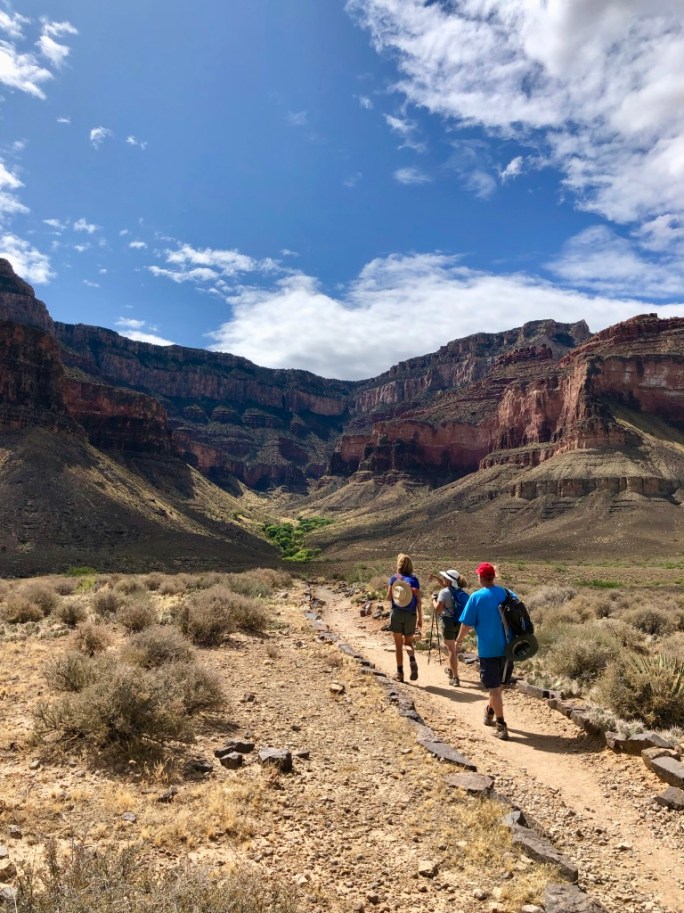
While the South Kaibab Trail follows a ridge line, the Bright Angel Trail conforms to a fault, keeping to the back of the canyon during the first few miles. Our view on the Bright Angel Trail was framed by massive cliffs and most of the elevation change happened in the first 4 miles. The rim is at 6800 feet and the trail drops roughly 1000 feet every mile and half.
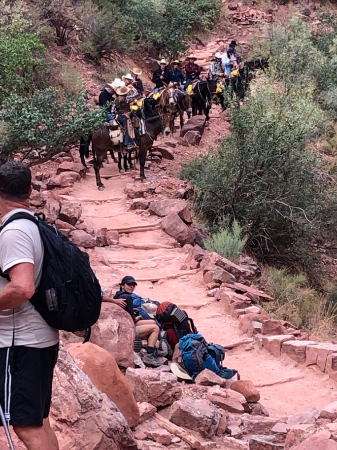
Actually, most everyone was faster than us. In fact many of the younger hikers would ask us “Do you need help?” It became a slight joke amongst ourselves, “No, we don’t need help, we’re just older than you.” Anyone going up the trail or passing someone had right of way so we stood to the side a multiple dozen’s of times. A few of the hikers were actually trail running, trying to make it all the way to the bottom and sometimes back up in one day. No thanks!
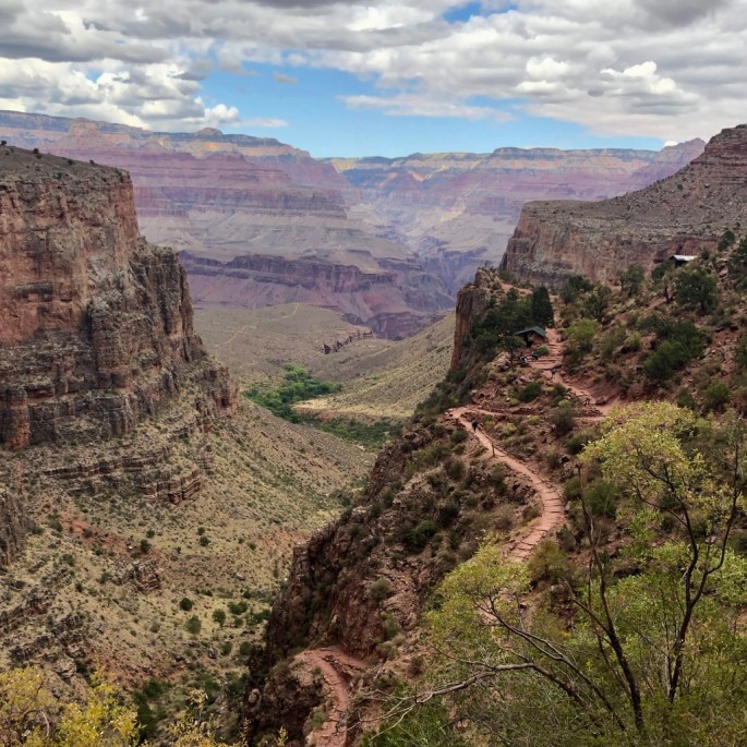
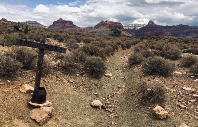
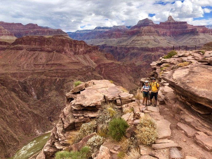
We could make out an enticing spot where the trail appeared to end abruptly. It look like it would be a great spot to peer into the Canyon. We all decided that was where we should strive to hike to. A young female park ranger hiked past us (naturally) and we asked her how far it was hike there. She informed us that area was called Plateau Point. It was 1.5 miles from the 3 mile rest stop to Indian Gardens, then another 1.5 of flat walking to Plateau Point. She also said part of her job was just hiking up and down the trail looking for people who required rescue. We let her know we were doing fine!
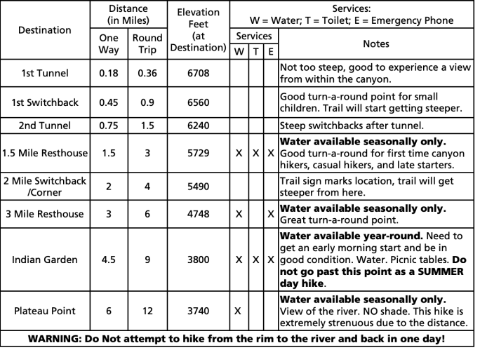
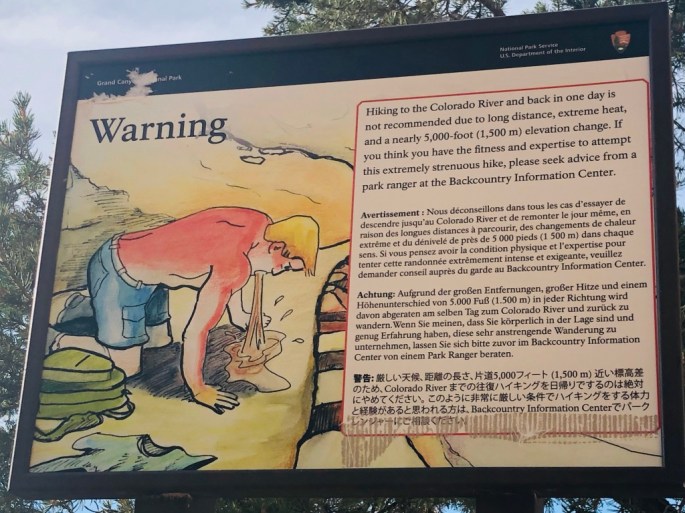
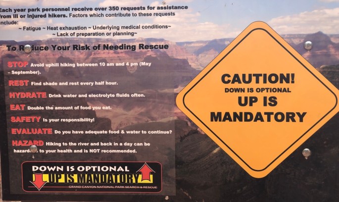
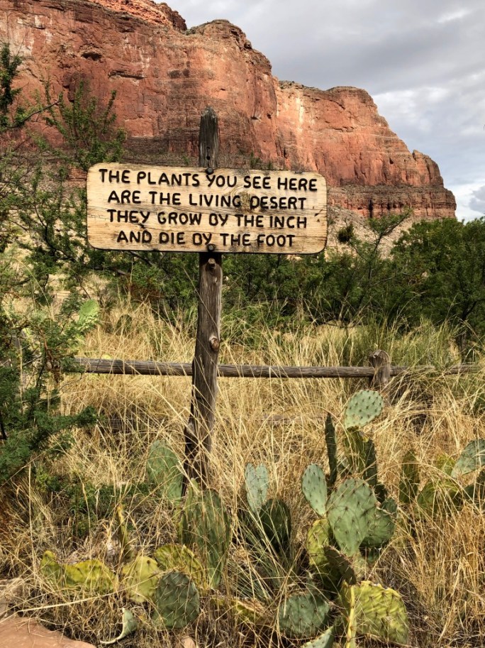
There are restrooms and water stations on the trail, hence the National Park Service says its “without question” the safest hiking trail in the Grand Canyon. BUT, other sites proclaim the Bright Angel Trail to be the second most dangerous trail in America! The problem is a lot of people are not prepared for the hike, either by not being in shape, not bringing enough water or not paying attention to their bodies if they are starting to struggle. There are about 200 rescues from the trail each year. The Park Service certainly does its best by sending rangers hiking the trail looking for people in distress and by posting many precautionary signs along the route.
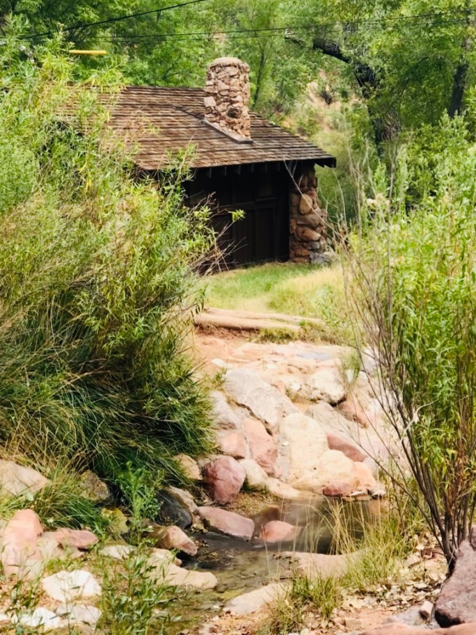
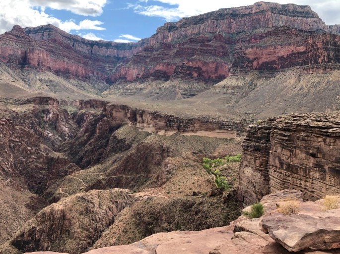
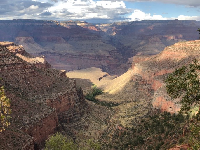
After 4.8 miles, we made it to Indian Gardens, where there was water and the flora and fauna changed. Trees were green, there was an active stream flowing and the terrain started leveling out. Another rest stop was available and there were many colorful tents with campers relaxing beside them.
The terrain changed after Indian Gardens to a desert landscape. Plateau Point was only 1.5 flattish miles after it, but I was starting to drag and the surroundings felt like a true dessert as the temperature definitely had risen as our elevation had decreased!
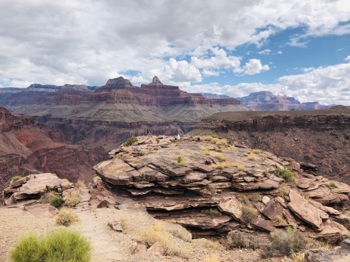
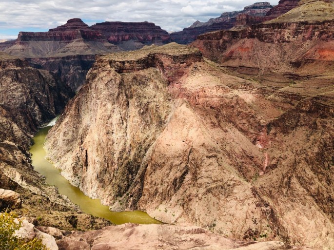
Plateau Point had amazing beauty and was certainly worth the hike! We stopped for many photos and a lunch break. A huge 2 foot tall raven kept us company and also kept an eye on our food.

We started back as we knew the way up would probably take us longer and it was already past noon. We only had to make it back to the top of those cliffs back in the corner!
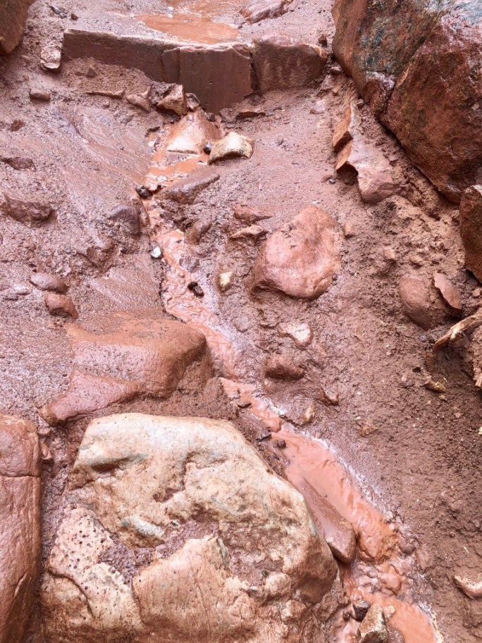
We were slowed down by about a 15 minute downpour that turned the trails into muddy rivulets, but it was over soon and we were as prepared as scouts with disposable ponchos. We passed a few drenched souls huddled under cliffs along the trail.
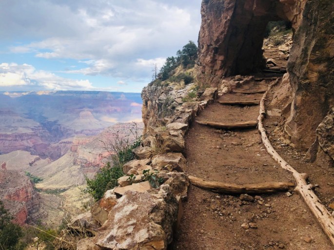
As we drew closer to the top, my husband decided he wanted to try trail running up to the top. I took his poles from him and elected to just walk. He admitted he ended up doing more of a jog/walk because we weren’t as close to the top as he had thought. I saw several people trying to take selfies out on a ledge which made me cringe. I did NOT want to witness a fall! I made it to the top about 45 minutes before sunset and the temperature began dropping into the 40’s.
We decided to drive to El Tovar for dinner, and although El Tovar is located barely 1/3 mile away, it had started raining again and we were chilled. Plus we were tired. Plus there was literally no outside lighting so it was completely pitch black and no one wanted to walk with flashlights in the rain. Parking was terrible and we couldn’t figure out how to even get into the restaurant. The food was at a delicious gourmet level which we felt we deserved after our hard work. I had a prickly pear margarita and a melt-in-your-mouth braised lamb shank. Returning to our little cabin and our wonderful, instantly-cheery fireplace was awesome. It felt delicious to just slide into bed and I fell asleep pretty much instantaneously with happy and tired bones.
A few things to keep in mind:
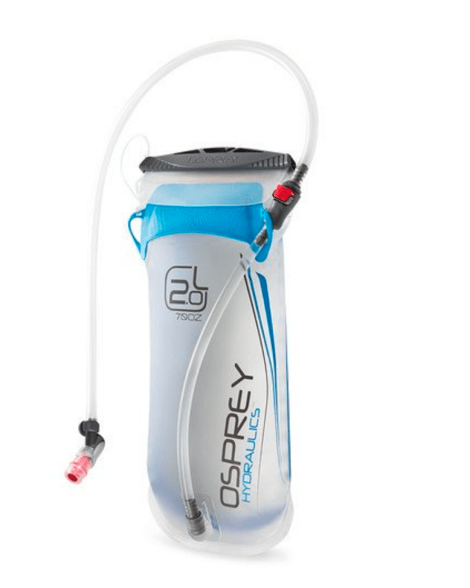
Please remember that this is a serious hike. Especially in the summer, it is easy to underestimate hydration needs and also to remember to replenish electrolytes. We took along some packets of electrolyte gel hydration packs and plenty of salty nuts and snacks. Part of the way down my quadriceps were shaking when we stopped, so I made sure to sit at each rest stop. I also used Leki trekking poles to take weight off my knees as I had torn a meniscus a few months prior and I believe this helped me still be able to do our hike. We also used Merrell hiking shoes as well as Osprey Daylite back packs with hydration reservoirs that slipped right into our packs. We had filled our 2.0 liter reservoirs with water and ice which had a tube attached with a magnet to our chest strap. That way we could sip on our water without stopping and hauling out a water bottle. It was awesome (thank you Rob and Jennifer)! Literally it was a life saver and so convenient!
Happy hiking!

Great post! I love the Bright Angel Trail! Of course I like it better going down then up lol!!!
LikeLike
Of course lol!
LikeLiked by 1 person
It is a really nice but very long hike. I remember doing it years ago in a day – and the first couple of miles were iced over so we had to wear crampons not to slip and fall over the edge.
LikeLike
Wow! We like hiking but that is serious when crampons are required- too serious for us.
LikeLiked by 1 person
Probably me too by now – fortunately the snow disappeared after the first mile or two when we made it down a bit. The weather got warmer as we went down.
LikeLike
Once again, I thoroughly enjoyed your post.
LikeLike
Thanks Mary!
LikeLike
Amazing pictures… and serious hiking. Glad to see it through your eyes!
LikeLike
Thanks for helping me train Sandy!
LikeLike