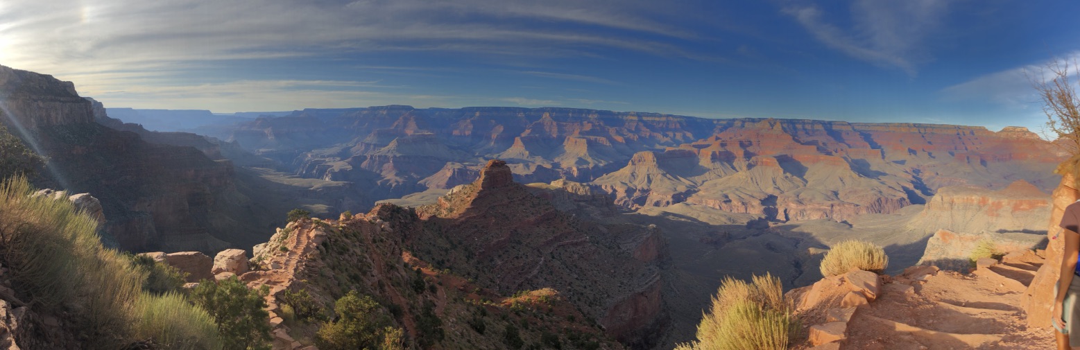
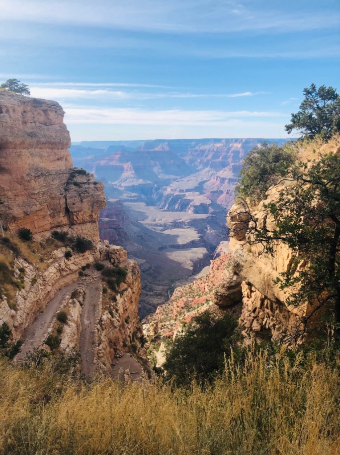
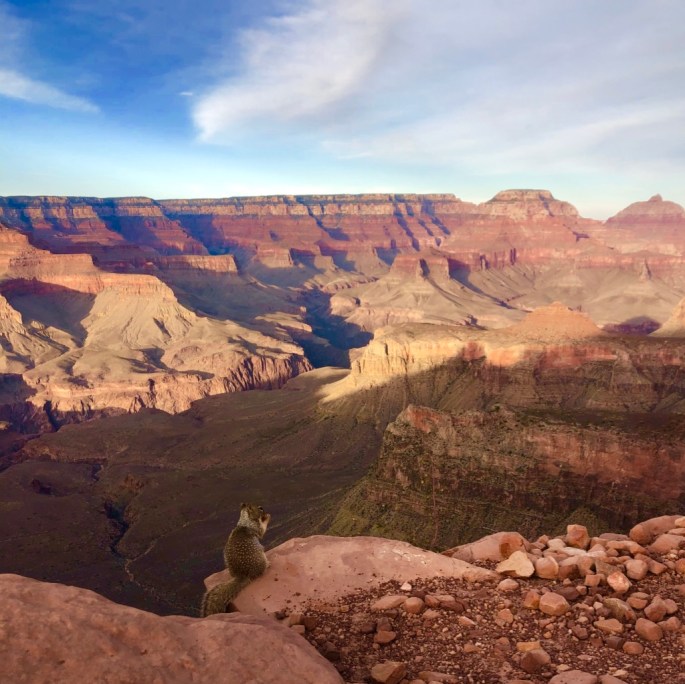
Majesty is a quality so impressive it takes your breath away- and the Grand Canyon has it. There is beauty in the symmetry of the sedimentary layers; the bold red colors melting into soft oranges and muted golds. One picture doesn’t feel like it can capture the magnificence as the view stretches out 180 degrees. Our first glance of the Grand Canyon came from the car as we drove slowly into the park. We parked in the Canyon View Information Plaza Parking lot and went out to Mather Point. This is an easy spot to walk up to the canyon and see its grandeur without hiking, hence it was crowded.

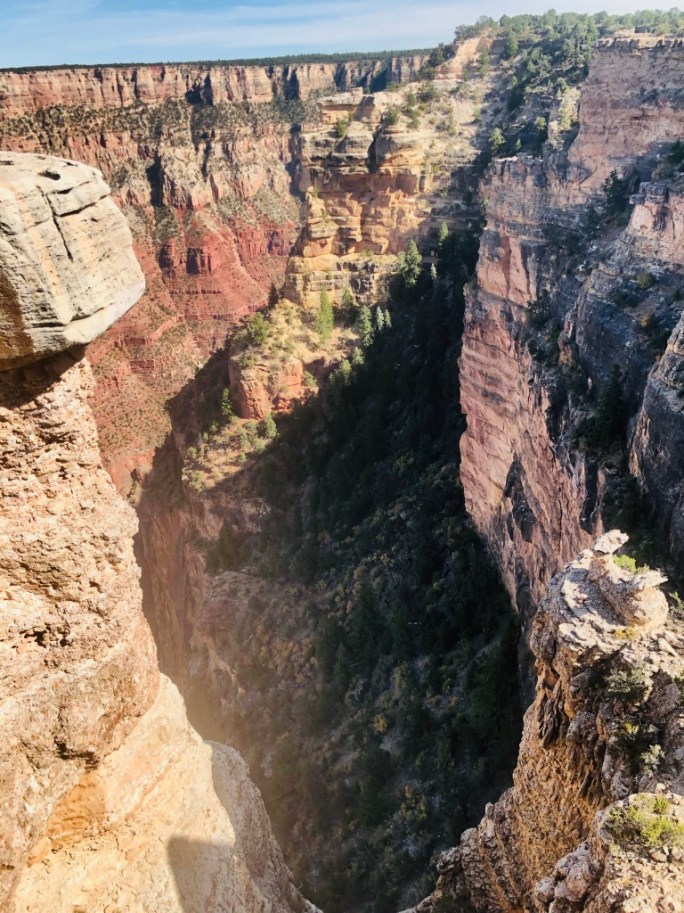
From here, we continued along the paved rim trail with vistas into the Canyon that compelled us to stop for pictures every 5 minutes. Sometimes there wasn’t anything blocking a person from doing the ultimate selfie that could cost them their life. About 12 people die every year at the Grand Canyon and about 5 of them are from falls.
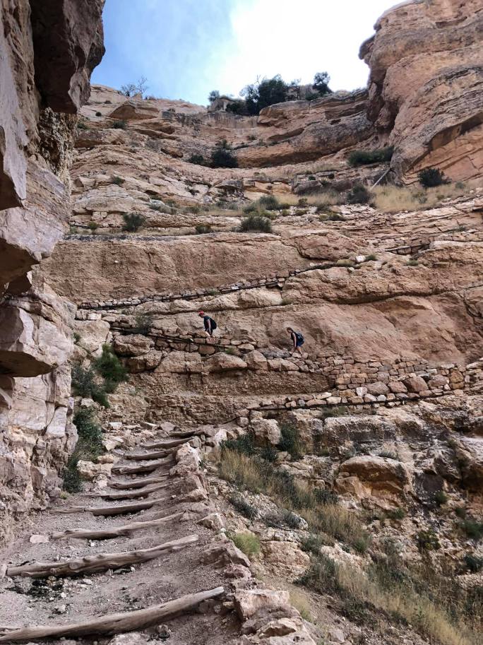
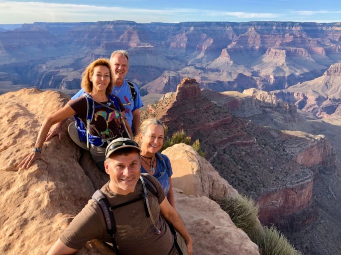
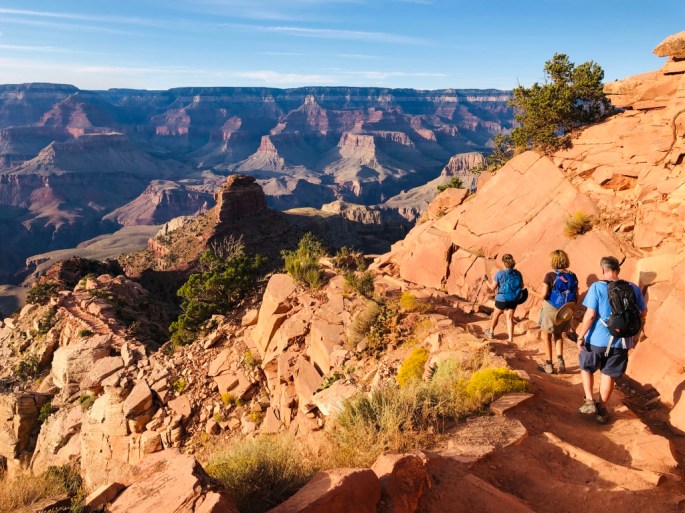
We continued walking along the Rim Walk with our ultimate goal of the South Kaibab trailhead. We were winging it because it didn’t look far on the little map we had glanced at. We ran into a quintessential park ranger; smiling, wizened, and perhaps even missing a tooth or two, who told us that it was only 1/2 hour left until the trailhead (and another 30 to the “Ooh Aah Point” which we didn’t know what the heck that was at the time). He wasn’t too far off but it ended up being 2 1/2 miles total from our start point. In retrospect, I would have suggested taking the Kaibab Rim Shuttle from Mather Point to save our time and energy for the South Kaibab, but it was a lovely walk along the rim.
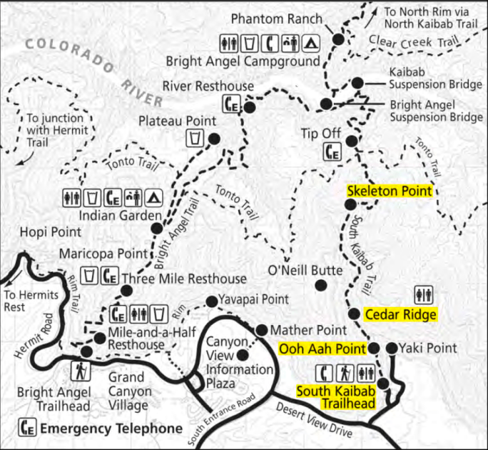
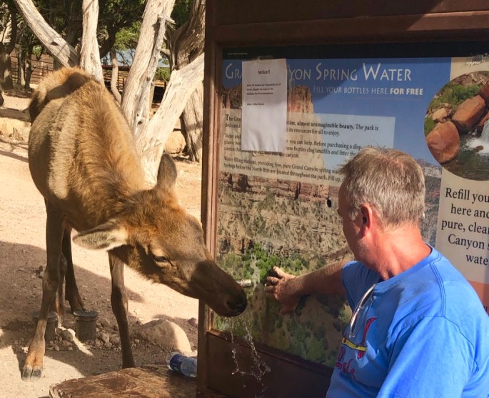
At the top of the Trailhead is a parking lot that was complete with a young elk standing at the water spigot. A few giggling Japanese tourists were taking turns turning on the spigot so the elk could drink. Our friend Rob took his turn providing this service also. The parking lot was pretty empty, making me wish we had driven, but later I learned that private cars can’t park there so the shuttle is the way to go.
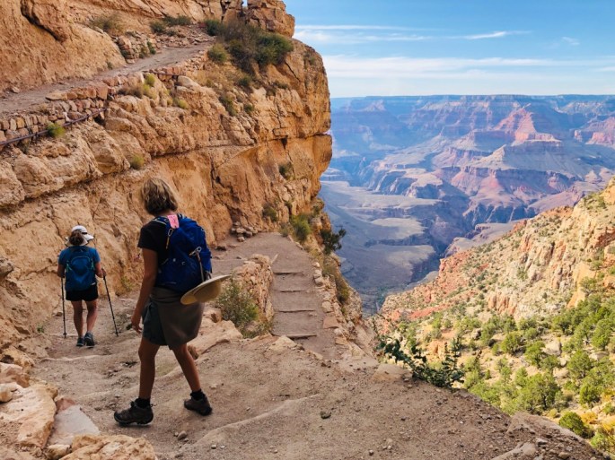
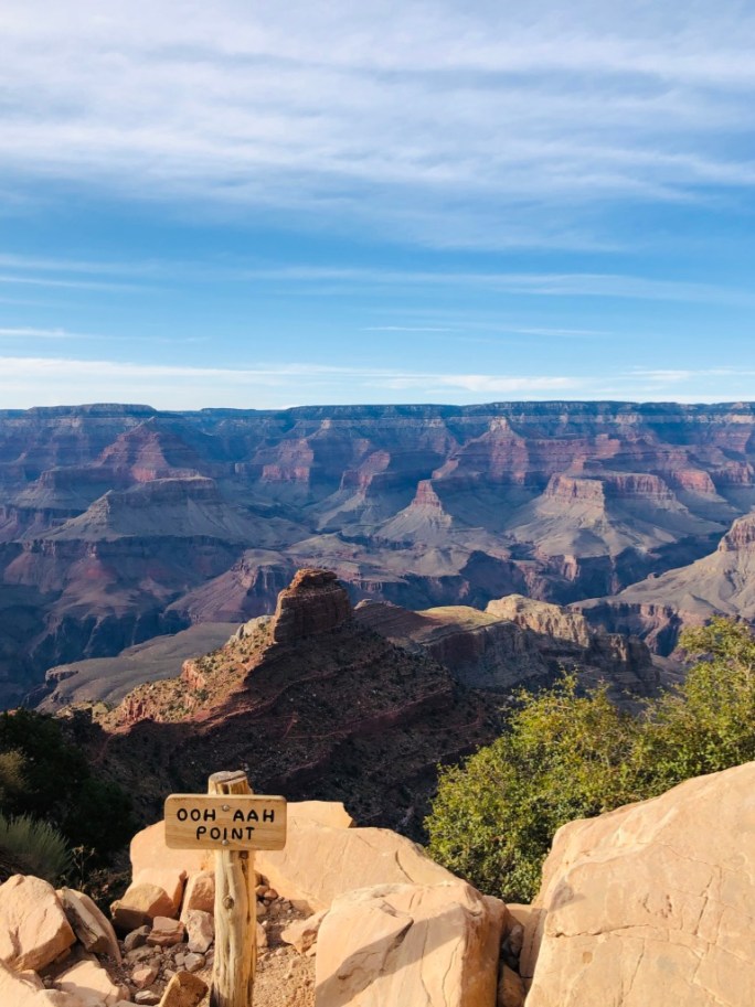
There were a few spots with relatively fresh evidence of mules, but no mules were sighted. Then we made it to the Ooh Aah Point, approximately at the one mile point on the trail and had to stop to take a few pics!

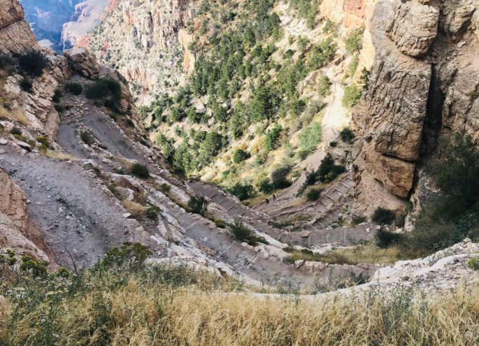
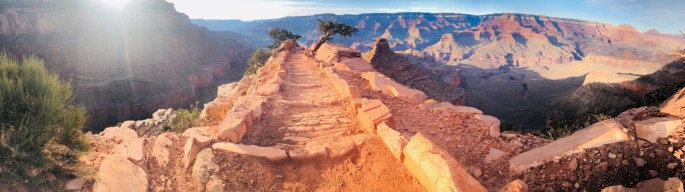
We continued down further because the trail along the ridge just looked so dang cool. If I could “do” our Grand Canyon hiking over, I would love to hike down the South Kaibab and up the Bright Angel Trail after staying over at Phantom Ranch down in the Canyon. I had attempted to get reservations at Phantom Ranch 13 months prior to our trip, but they had just changed the reservation system to requiring 15 months ahead of time to secure a spot (or even to just enter a lottery for a spot!) and I didn’t want to push our trip back to the next year. I was able to snare a Wednesday and Thursday night at Bright Angel Lodge in a rim cabin and I was quite happy with that after all was said and done.


,
The bus continued on to Yaki Point at the end of the shuttle bus loop and would have been a great place to see the sunset, but the shuttle stops running 30 minutes after sunset and it was 3 miles from our car. We were pretty happy to head back to our car so we could check into our rooms at the Bright Angel Lodge. Later that night I can vouch that the Bright Angel Restaurant offered a tasty trout served by smiling interns from around the world.
Things to consider when planning your trip

We loved the Grand Canyon. Used to go there and just sit and watch the sun go over the canyon, The walls of the Canyon would change colors as the sun moved. Thanks for bringing back the memories!
LikeLiked by 1 person
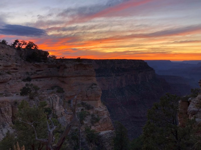
Shirley I am glad that my post brought back memories! I definitely noticed how the colors changed from reds to oranges to yellows then somehow purples at sunset. Hope Ray is doing well. Condolences about his son.
LikeLike